Hikes and Outdoor Spots Near Mesquite, Nevada, Sorted by Distance
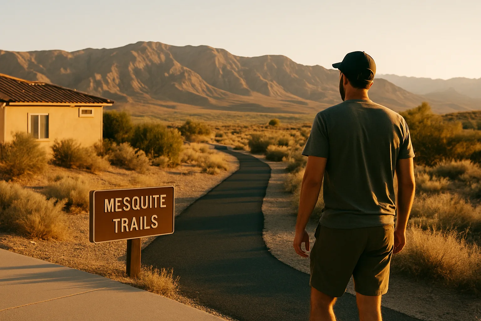
Mesquite's 60 miles of city trails are only the start. This guide sorts nearby hikes and outdoor spots by distance, with land-manager details on access, seasons, heat and road conditions.
The City of Mesquite says it maintains 60 miles of trails for walking, hiking and biking. Beyond the city limits, the desert opens into a national monument, a Bureau of Land Management river canyon and two state parks, all reachable on a day trip. For anyone weighing a move, the real question is less "is there anywhere to hike?" and more "which places work in which season, and how far is each one?" This guide sorts the options by distance from town, from neighborhood paths to full-day outings, and adds the heat and road details that land managers emphasize.
Start With the Calendar, Not the Map
Desert hiking around Mesquite runs on a seasonal schedule. The Bureau of Land Management warns that temperatures in Gold Butte National Monument range from over 100 degrees in summer to below freezing in winter, and that flash floods are common. Nevada State Parks closes many of the trails at Valley of Fire every year from May 15 through September 30 because of heat. Utah State Parks advises Snow Canyon visitors to avoid hiking, biking and similar activity between 11 a.m. and 7 p.m. in summer.
In practice, the longer trips covered below fit best from fall through spring. Summer outings shift to early mornings, short walks and shaded parks in town. Outdoor Nevada's guide to Gold Butte's Little Finland area names spring (March to May) and fall (September to November) as the best times to go.
In Town: Paths and Parks Close to Home
Much of Mesquite's everyday walking happens on the city's trail network, which links neighborhoods and parks. According to the city's parks directory, Hunter Sports Park, Library Park, Old Mill Park, Pioneer Park and Pulsipher Park each connect to the trail system. That makes it possible to string a morning walk together without driving to a trailhead.
Mesquite Regional Park Trailhead
The city lists the Mesquite Regional Park Trailhead on Lower Flat Top Drive, open daily from 5 a.m. to 10 p.m. It is the closest thing to a desert hike inside the city, with open terrain rather than landscaped park grounds. A closer look at the trail is in the Mesquite Regional Park overview.
Hafen Park and the other neighborhood parks
For shorter outings, Hafen Park on Hafen Lane has a fishing pond with a bridge to an island, a shaded playground, covered pavilions and four lighted tennis courts, according to the city. Details on hours and the pond are in the Hafen Lane Park guide. Other options from the city's list include:
- Hillside Arboretum: a tree-lined pathway with a picnic table.
- Marilyn Redd Park: a path system, a covered lighted pavilion and a shaded playground.
- Desert Rose Park: covered pavilions, restrooms and a playground the city describes as 60% shaded.
- Animal Control Dog Park: bags and disposal stations provided for dog owners.
The city also lists two off-highway-vehicle staging areas, the Championship Way OHV Staging Area and the Riverside OHV Staging Arena, for residents who explore by side-by-side rather than on foot.
Close to Town: Flat Top Mesa and the Virgin River Gorge
Flat Top Mesa
The mesa that rises above Mesquite appears on the State of Nevada's Off Road Nevada trail finder as an off-highway-vehicle area reached from the city's streets. The state's listing describes a trailhead with an information kiosk and trail map, and it asks visitors to stay on designated routes because nearby land includes private property, state rights-of-way and utility land. The mesa's sides are steep cliffs, so anyone exploring the top should keep well back from the rim and check current route conditions before going.
Virgin River Canyon Recreation Area (Arizona)
About 20 miles from Mesquite along Interstate 15, the BLM's Arizona Strip Field Office runs the Virgin River Canyon Recreation Area, reached from the Cedar Pocket exit at milepost 18. The BLM lists these trails and distances:
- River Trail: 0.1 mile to the Virgin River
- Canyon Overlook Trail: 0.4 mile, paved and ADA accessible
- Ridgeline Loop: 1.1 miles
- Narrows: 1.4 miles
- Greyhaven Pinnacle: 1.8 miles, a scramble
Sullivan Canyon Trail also starts here and continues into the Paiute Wilderness. Day use costs $2 per vehicle and is free with a displayed America the Beautiful pass, according to the BLM, and the campground has 108 sites with a 14-night limit. The agency describes the gorge's climate as typical Mojave Desert, with hot summers and mild winters. The history of the campground's reopening is covered in the Virgin River Recreation Area post.
Day Trips: Gold Butte, Valley of Fire and Snow Canyon
Gold Butte National Monument
South of Mesquite and Bunkerville, the BLM's Las Vegas Field Office manages the 296,937-acre Gold Butte National Monument. Access starts at I-15 Exit 112 (State Route 170). From there, drivers head south on SR 170 to the Gold Butte Backcountry Byway, then about 12 miles to the monument boundary. The BLM brochure gives these approximate distances from the SR 170 and byway intersection:
- Whitney Pockets, about 21 miles: the best-known and most accessible Aztec sandstone formations in the monument, with rock art left by ancient Indigenous people and structures built by the Civilian Conservation Corps in the 1930s. The paved section of the byway ends here.
- Devil's Throat, about 28 miles: a sinkhole roughly 100 feet deep that keeps growing as underground water dissolves minerals in the soil.
- Gold Butte Townsite, about 41 miles: building foundations and ore-crushing equipment left from an early-1900s mining boom.
Vehicles matter here. The BLM says Whitney Pockets is accessible by most vehicles, but high-clearance, four-wheel-drive vehicles are highly recommended everywhere else. Drivers should be ready for washouts, deep sand and gravel, and rock slides. Little Finland, an area of red sandstone formations known as hoodoos, sits farther along unpaved roads. Outdoor Nevada's guide to that area says high-clearance four-wheel-drive or all-wheel-drive vehicles are necessary.
The monument is remote. The BLM brochure states there is no cellular phone service, advises bringing plenty of water and telling someone the plan and return time, and notes that camping is limited to 14 days in a 28-day period. The northern part of the monument is critical habitat for the threatened desert tortoise, which visitors should not touch or disturb.
Valley of Fire State Park
Valley of Fire State Park, near Overton, makes a full-day outing from Mesquite. Nevada State Parks lists these details:
- Established in 1935, with about 40,000 acres of red Aztec sandstone
- Open daily from sunrise to sunset; visitor center open 9 a.m. to 4 p.m.
- Day-use entry of $10 per vehicle for Nevada vehicles and $15 for non-Nevada vehicles
- Closed to visitors every year from December 1 through December 14 for maintenance
- Many trails, including the Fire Wave, Seven Wonders, Pastel Canyon and Pink Canyon routes, closed annually May 15 through September 30
- Pets welcome on a leash no longer than six feet, but not inside the visitor center
The park's page also notes that trails often feel longer than listed and that hiking in high heat is dangerous even on short routes.
Snow Canyon State Park (Utah)
Across the state line in Ivins, near St. George, Snow Canyon State Park sits within the 62,000-acre Red Cliffs Desert Reserve. Utah State Parks lists more than 38 miles of hiking trails, hours of 6 a.m. to 10 p.m., and a paved Whiptail Trail for walking and biking. Johnson Canyon trail is closed from March 15 through September 14 except for ranger-guided hikes. The park warns that summer highs can reach 117°F and recommends at least one liter of water per person per hour.
Quick Reference by Distance
| Destination | Managed by | Access notes | Seasonal note |
|---|---|---|---|
| City trails and parks | City of Mesquite | Paved paths; several parks connect to the trail system | Year-round; summer use best early or late |
| Flat Top Mesa | Listed on the State of Nevada's Off Road Nevada trail finder | Four-wheel-drive route; stay on designated routes | Cooler months |
| Virgin River Canyon Recreation Area | BLM Arizona Strip Field Office | I-15 Cedar Pocket exit; short marked trails | Hot summers, mild winters |
| Gold Butte National Monument | BLM Las Vegas Field Office | Paved to Whitney Pockets; high clearance beyond | Over 100°F in summer; no cell service |
| Valley of Fire State Park | Nevada State Parks | Entry fee; paved park roads | Many trails closed May 15 to Sept. 30; park closed Dec. 1 to 14 |
| Snow Canyon State Park | Utah State Parks | In Ivins, Utah | Avoid activity 11 a.m. to 7 p.m. in summer |
A Heat and Safety Checklist for Desert Outings
Land-manager guidance for all of these places points to the same habits:
- Time the outing. In warm months, finish before late morning. Utah State Parks advises avoiding activity between 11 a.m. and 7 p.m. in summer.
- Carry more water than seems necessary. Utah State Parks recommends at least one liter per person per hour, and Nevada State Parks stresses replacing electrolytes.
- Share the plan. The BLM asks Gold Butte visitors to tell family or friends where they are going and when they will return.
- Do not count on a phone signal. Gold Butte has no cellular service, according to the BLM.
- Watch the sky and the washes. Flash floods are common in the region, and rain can wash out dirt roads.
- Match the vehicle to the road. Beyond the pavement at Whitney Pockets, the BLM highly recommends high-clearance, four-wheel-drive vehicles.
- Know the signs of heat illness. Utah State Parks lists heavy sweating, nausea, dizziness and muscle cramps as heat-exhaustion symptoms; the response is to rest, rehydrate or turn back.
What This Means When Choosing a Home
For buyers who plan to spend a lot of time outdoors, location within Mesquite affects daily routines. A home near a park that connects to the trail system makes a sunrise walk easy in July. A garage with room for a high-clearance vehicle or trailer matters more for anyone planning regular trips into Gold Butte. Many buyers also look for views of the surrounding ridges and mesas; current Mesquite homes with mountain views show how that plays out across neighborhoods.
Price is part of the picture too. The current median list price of active Mesquite listings is $419,000, and the full range of single-family homes in Mesquite includes properties near the city's parks and trail corridors. Buyers comparing neighborhoods can start with all homes for sale in Mesquite, Nevada and map each one against the parks and trailheads above. More local guides are available at Homes For Sale In Mesquite Nevada.
Frequently asked questions
How many miles of trails does the City of Mesquite have?
The City of Mesquite says it has 60 miles of trails for walking, hiking and biking. Several city parks, including Hunter Sports Park, Library Park, Old Mill Park, Pioneer Park and Pulsipher Park, connect to that trail system.
When is the best time of year to hike near Mesquite, Nevada?
Fall through spring is the most comfortable hiking season around Mesquite. Summer temperatures in nearby areas such as Gold Butte National Monument can exceed 100 degrees, and Valley of Fire State Park closes many trails from May 15 through September 30. Summer outings work best early in the morning on short, close-to-town routes.
Do you need a four-wheel-drive vehicle to visit Gold Butte National Monument?
Not for every stop. The Bureau of Land Management says Whitney Pockets, where the paved section of the byway ends, is accessible by most vehicles. Beyond that point, the BLM highly recommends high-clearance, four-wheel-drive vehicles because of washouts, deep sand and gravel, and rock slides.
Is there cell phone service in Gold Butte National Monument?
The Bureau of Land Management states there is no cellular phone service in Gold Butte. Visitors should tell someone where they are going and when they plan to return, and should carry plenty of water.
How much does it cost to enter Valley of Fire State Park?
Nevada State Parks lists day-use entry at $10 per vehicle for Nevada vehicles and $15 for non-Nevada vehicles. The park is open from sunrise to sunset and closes to visitors each year from December 1 through December 14 for maintenance.
What trails are at the Virgin River Canyon Recreation Area near Mesquite?
The BLM lists the River Trail (0.1 mile), the paved Canyon Overlook Trail (0.4 mile), the Ridgeline Loop (1.1 miles), the Narrows (1.4 miles) and Greyhaven Pinnacle (1.8 miles, a scramble). The area is about 20 miles from Mesquite off the I-15 Cedar Pocket exit, and day use costs $2 per vehicle.
Homes for sale in Mesquite, Nevada
Thinking about a move to Mesquite?
Browse every active listing — Sun City 55+, golf-course homes, new construction and more — updated multiple times a day. Or talk to a local agent who knows the neighborhoods.
Keep reading
More from the blog
Finding the Marketing Hook in an Ordinary Property
Buying a Mesquite Retirement Home With a Reverse Mortgage (2026)

FHA Loans in Mesquite, NV: 2026 Limits, Down Payments and MIP