Driving I-15 Through the Virgin River Gorge: What Mesquite Residents Should Know
Mesquite depends on St. George for major medical care, shopping and flights, and the only freeway there runs through the Virgin River Gorge. Here is what has been rebuilt, what is planned and how to handle a closure.
The nearest large hospital, the nearest big-box shopping district and the nearest commercial airport to Mesquite are all in St. George, Utah, and one road leads there: Interstate 15 through the Virgin River Gorge. The trip is short, roughly 40 miles, but about 29 of those miles belong to Arizona and run through one of the tightest canyons on the interstate system. Buyers who plan to use St. George regularly should know how that road was built, what has been repaired, what is scheduled next and what to do when it shuts down.
A 29-Mile Piece of Arizona Between Two Other States
I-15 crosses the far northwest corner of Arizona for about 29 miles, entering from Nevada just past Mesquite and leaving into Utah a few miles south of St. George. The stretch has only four interchanges: Exit 8 for Beaver Dam and Littlefield, Exit 9 for Desert Springs, Exit 18 at Cedar Pocket and Exit 27 at Black Rock Road. Between Exit 9 and Exit 27 the freeway is inside or climbing out of the gorge, and Cedar Pocket is the only place to leave it.
The corridor carries far more than local traffic. The Arizona Department of Transportation (ADOT) has said about 1.4 million trucks a year use this segment, which links Southern California and Las Vegas with Salt Lake City and the Rocky Mountain states. Mesquite drivers heading to a medical appointment share two lanes in each direction with that freight.
Why the Road Is So Tight
Before the interstate, traffic between Nevada and southern Utah avoided the canyon. U.S. Route 91 turned north at Littlefield, climbed over the Beaver Dam Mountains and dropped into St. George from the west. When the interstate was planned, federal highway officials chose the gorge instead because it was about 12 miles shorter and gave trucks gentler grades.
Building it took about a decade. According to ADOT's own history of the project, the Arizona Highway Department spent more than $48 million, or about $1.63 million per mile, on the four-lane highway and its seven bridges, and the job was among the most difficult and costly road projects of its era. The final 3.8 miles through the lower gorge alone cost $13.85 million. Surveyors laid out the line on the rock face with the help of climbers, the contractor's access road crossed the river 18 times, and the Virgin River itself was rechanneled a dozen times to make room. The gorge section opened to traffic on Dec. 14, 1973.
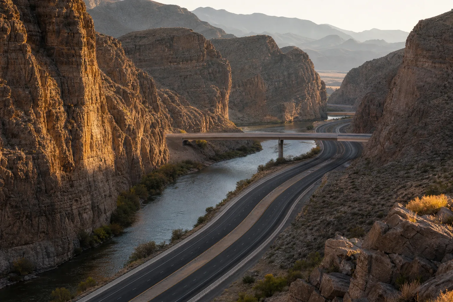
What all that money could not buy was extra width. The roadway, its bridges and the river share the canyon floor, so the lanes curve tightly between rock cuts and barrier walls, and room to pull off is limited. ADOT's project notices refer plainly to "the narrow width of I-15" in the gorge. During past bridge work, when lanes were squeezed to 10 feet, every vehicle wider than 10 feet was sent on a 224-mile detour by way of U.S. 93, Nevada State Route 319 and Utah State Route 56.
What ADOT Has Fixed Since 2014
The gorge bridges date to the 1960s and early 1970s, and ADOT has spent more than a decade working through them. The record so far:
- 2014 to 2016: a $27 million rehabilitation of Bridge No. 6, which stands about 100 feet above the river. Crews replaced girders, decks and railings and widened the roadway. It was the centerpiece of about $50 million in upgrades that also repaved Arizona's entire stretch of I-15 and repaired the decks of three other bridges. ADOT announced completion in July 2016.
- April 2019 to July 2020: a $6.4 million project that resurfaced the decks of Bridges No. 2 and No. 5 and gave Bridge No. 4 a new deck.
- Fall 2020: repairs to the guardrail, barrier wall and deck of Bridge No. 7 at milepost 22 after a semi-truck crashed and burned on the bridge that August.
- February 2021 to spring 2024: full replacement of Bridge No. 1 near Littlefield, a $56 million project that rebuilt the abutment foundations, piers and deck one half at a time while traffic kept moving. ADOT, which had said the project would add wider shoulders, announced on April 30, 2024 that the bridge was fully open.
ADOT's Bridge No. 1 project page now lists that job as complete. St. George News described it at the time as the last in the series of gorge bridge projects that began in 2014.
What Is Scheduled as of Late 2026
No bridge construction zone was announced for the gorge in 2026, and no new ADOT bridge project there could be confirmed as of early November 2026. The next large item on record is pavement. Arizona's 2027 to 2031 five-year construction program, includes $82.6 million to rehabilitate 16.4 miles of I-15 pavement from the Virgin River Gorge to the Utah state line, according to Government Market News coverage of the program. A start date has not been published in the sources reviewed for this article. When that work begins, lane restrictions in the canyon are likely, and the wide-load detour used during earlier projects could return.
Five-year programs are revised annually, so the pavement project is best treated as expected but unscheduled.
How Closures Reach Mesquite
Most disruptions in the gorge come from crashes, not construction, and they tend to block everything because there is so little room to move a damaged vehicle aside. Three examples show the range:
- On Aug. 8, 2020, a semi-truck crashed and caught fire on Bridge No. 7. Northbound I-15 was closed for much of the day, and St. George News published photos of traffic backed up in Mesquite.
- On Oct. 11, 2026, a car that rolled onto its roof blocked both lanes in the gorge for about 30 minutes, according to the Beaver Dam-Littlefield fire chief.
- On Oct. 21, 2026, a pickup struck a barrier wall near milepost 24 and dropped about 100 feet down an embankment, the Arizona Department of Public Safety said. Both occupants were taken to a St. George hospital with minor injuries, and St. George firefighters crossed the state line to assist.
The last example points to something new residents rarely consider: emergency response in the canyon comes from a small Arizona fire district and from St. George, and both can be delayed by the same backup they are trying to reach.
For Mesquite households, the practical exposure is to anything on a clock. Mesquite has its own 25-bed hospital for emergencies and routine care, but many specialists and the region's Level II trauma center are in St. George. The details are in the overview of healthcare in Mesquite. Flights from St. George Regional Airport and scheduled procedures both deserve a time cushion.
The Alternate Route: Old Highway 91
The road the interstate replaced is still open. Old Highway 91, leaves I-15 at Exit 8 in Beaver Dam, climbs over the Beaver Dam Mountains, crosses the Shivwits Band of Paiutes reservation and enters the St. George area through Ivins and Santa Clara. St. George News traffic advisories have repeatedly recommended it during long gorge backups.
It is a real alternative with real limits:
- It is a two-lane mountain road with a summit near 4,500 feet, so it is slower than the freeway and can see winter weather the valley floor does not.
- When the gorge closes, much of the diverted traffic takes it at once.
- During past lane restrictions, ADOT directed vehicles too wide for the gorge to the 224-mile signed detour.
Practical Advice for the Drive
- Check before leaving. Arizona posts live conditions on az511.gov and by phone at 511. The decision to use Old Highway 91 has to be made at Exit 8 northbound or before entering the freeway southbound.
- Remember the time change. Mesquite keeps Pacific time and St. George keeps Mountain time, so a 10 a.m. appointment in St. George is 9 a.m. on a Mesquite clock.
- Slow down for the curves. Sight lines in the canyon are short, and a stopped vehicle may be just past the next rock wall.
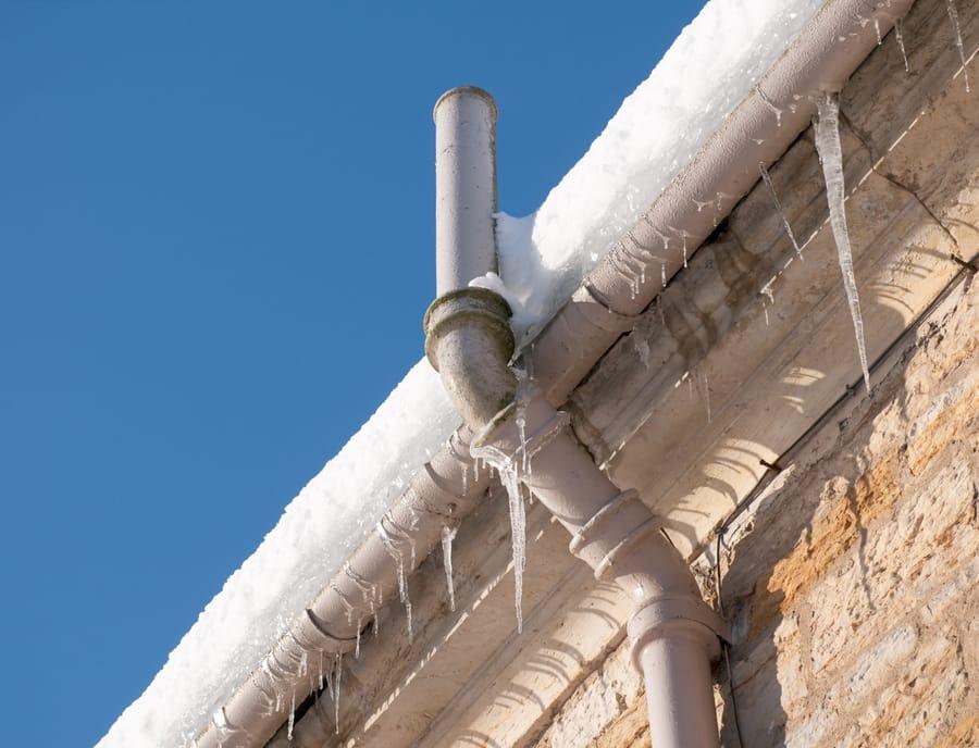
- Watch for ice in winter. ADOT's history quotes the original project supervisor saying parts of the canyon get no sun in the winter months, which means shaded pavement can stay frozen after the rest of the road has dried.
- Keep the tank and the water bottle full. A summer closure can mean an hour or more in a stopped car in desert heat.
What It Means for Choosing a Home in Mesquite
The gorge is one of the honest trade-offs of living in Mesquite. Residents get Nevada's tax structure and lower-key pace with a larger Utah city close by, and most trips through the canyon are uneventful and scenic. The surrounding desert also holds several of the outdoor spots near Mesquite.
The road still deserves a place on a buyer's checklist. Households that expect weekly specialist visits should ask how often those visits can be handled in town or by telehealth. Buyers weighing the two cities directly can compare them in the breakdown of Mesquite versus St. George, and the wider list of compromises appears in five trade-offs to evaluate before buying. The drive in the other direction has its own bottlenecks, covered in the report on I-15 between Mesquite and Southern California.
Current listings and neighborhood guides for buyers who decide the trade is worth it are available at Homes For Sale In Mesquite Nevada.
Frequently asked questions
How far is St. George from Mesquite on I-15?
St. George, Utah is roughly 35 to 40 miles northeast of Mesquite on Interstate 15. About 29 of those miles cross the northwest corner of Arizona, including the Virgin River Gorge. St. George is on Mountain time, one hour ahead of Mesquite.
Is there bridge construction in the Virgin River Gorge right now?
The Arizona Department of Transportation announced on April 30, 2024 that the $56 million replacement of Virgin River Bridge No. 1 near Littlefield was finished and fully open. No new gorge bridge project could be confirmed as of early November 2026. Current conditions are posted on az511.gov and by phone at 511.
What I-15 work is planned in the gorge next?
Arizona's 2027 to 2031 five-year construction program includes $82.6 million to rehabilitate 16.4 miles of I-15 pavement from the Virgin River Gorge to the Utah state line, according to Government Market News. No start date had been confirmed as of early November 2026, and five-year programs are revised annually.
What is the alternate route when the Virgin River Gorge is closed?
Old Highway 91 leaves I-15 at Exit 8 in Beaver Dam, Arizona, crosses the Beaver Dam Mountains and the Shivwits reservation, and reaches the St. George area through Ivins and Santa Clara. It is a two-lane mountain road with a summit near 4,500 feet, so it is slower than the freeway and fills quickly during a closure.
Why is I-15 so narrow through the Virgin River Gorge?
The highway, its bridges and the Virgin River all share the floor of a tight canyon. Federal officials chose the gorge over the older U.S. 91 route because it was about 12 miles shorter with gentler truck grades. Arizona spent more than $48 million and about a decade building it before the gorge section opened on Dec. 14, 1973.
Can oversize vehicles drive through the Virgin River Gorge?
During past ADOT bridge projects, lanes were narrowed and vehicles wider than 10 feet were required to use a 224-mile detour on U.S. 93, Nevada State Route 319 and Utah State Route 56 between Las Vegas and Cedar City. Owners of wide RVs or trailers should check az511.gov for any active restriction before a trip.
Homes for sale in Mesquite, Nevada
Thinking about a move to Mesquite?
Browse every active listing — Sun City 55+, golf-course homes, new construction and more — updated multiple times a day. Or talk to a local agent who knows the neighborhoods.
Keep reading
More from the blog

What Does It Mean When a Business Is Dissolved? Why Closed Contractors Still Show Up Online

Redfin Counts 1.51 Million Home Sellers and 929,000 Buyers: How to Read the Record Gap
Zillow's 2027 Outlook: Slightly Lower Rates, Flat Sales, Rising Rents and a Fight Over Private Listings